Antique Facsimile Hand Colored Engraving of and 41 similar items
Envío gratis
Antique Facsimile Hand Colored Engraving of America nova Tabula Guiljelmo Blaeuw
Share & earn! Sign in, share this or any listing, and you’ll get commission when it sells.
Learn more
View full item details »
Las opciones de envío
Los buques de 2 business days Detalles
No hay precio de envío se especifica en MX
Los buques de
United States

Política de oferta
OBO - El vendedor acepta ofertas en este artículo.
Detalles
La política de devoluciones
Partial refund available within 30 days
Protección de compra
Opciones de pago
PayPal accepted
PayPal Credit accepted
Venmo accepted
PayPal, MasterCard, Visa, Discover, and American Express accepted
Maestro accepted
Amazon Pay accepted
Nuvei accepted
View full item details »
Las opciones de envío
Los buques de 2 business days Detalles
No hay precio de envío se especifica en MX
Los buques de
United States
Política de oferta
OBO - El vendedor acepta ofertas en este artículo.
Detalles
La política de devoluciones
Partial refund available within 30 days
Protección de compra
Opciones de pago
PayPal accepted
PayPal Credit accepted
Venmo accepted
PayPal, MasterCard, Visa, Discover, and American Express accepted
Maestro accepted
Amazon Pay accepted
Nuvei accepted
Rasgos del artículo
| Categoría: | |
|---|---|
| cantidad disponible: |
Sólo uno en stock, para muy pronto |
| Condition: |
Unspecified by seller, may be new. |
| Original/Reproduction: |
Antique Reproduction |
| Date Range: |
1800-1899 |
| Year: |
1870 |
| Cartographer/Publisher: |
Willem Blaeu |
| Country/Region: |
Americas |
Detalles del anuncio
| Las políticas del vendedor: | |
|---|---|
| Envío de descuento: |
Vendedor paga el envío para este artículo. |
| Publicado en venta: |
Más de una semana |
| Artículo número: |
1293356468 |
Descripción del Artículo
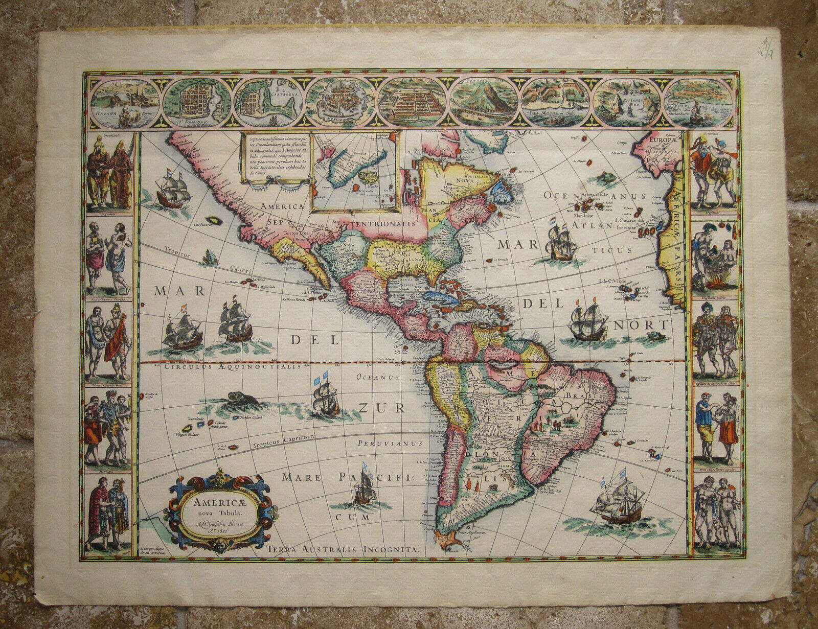
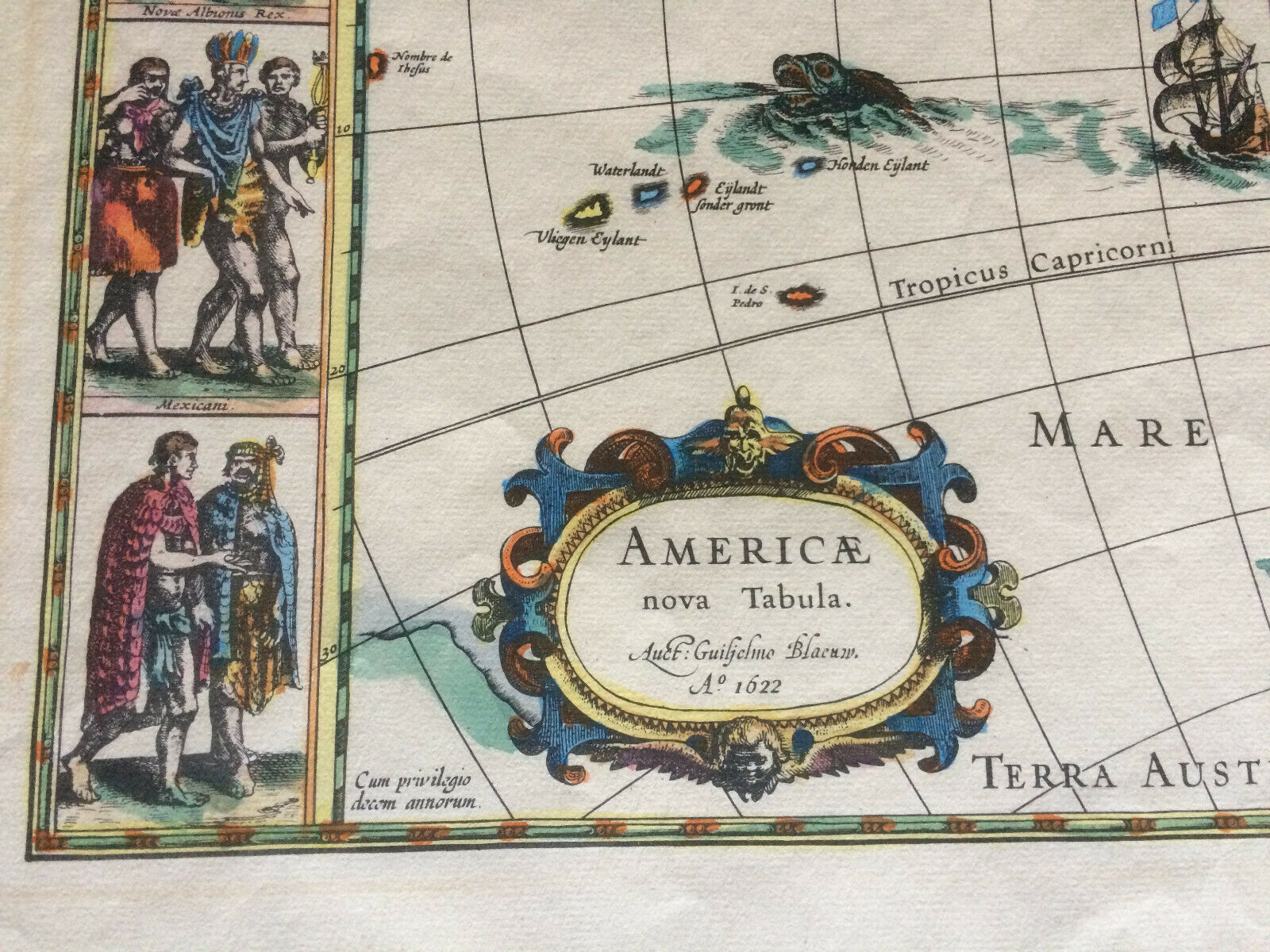
Beautiful Antique Facsimile (1870-1890) Hand Colored Engraving of America
nova Tabula (new map of america)
By Guiljelmo Blaeuw
Marked:
AMERICAE
Nova Tabula
Auct: Guiljelmo Blaeuw
A 1621
On laid paper from ARCHES (1869) with watermark INGRES D’ARCHES
MBM.
Size:
Sheet 19" x 24.5"
Plate Imprint 16.75" x 22.25"
Map Area 16" x 21.75"
Map
State 3 facsimile copper engraving,
hand colored with latin text.
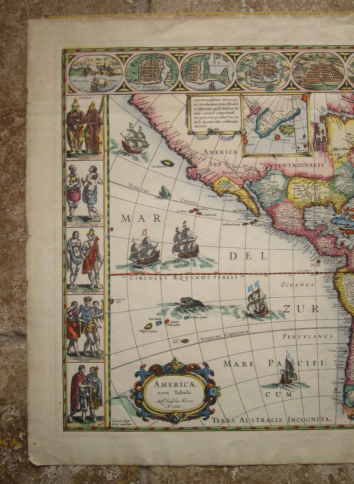
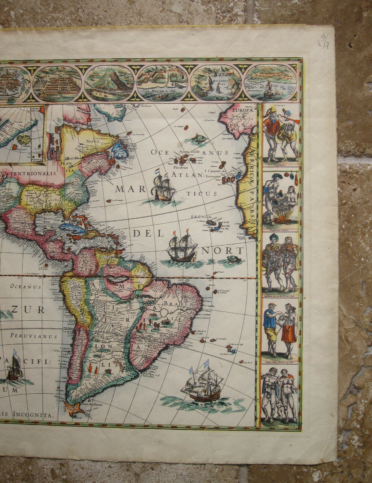
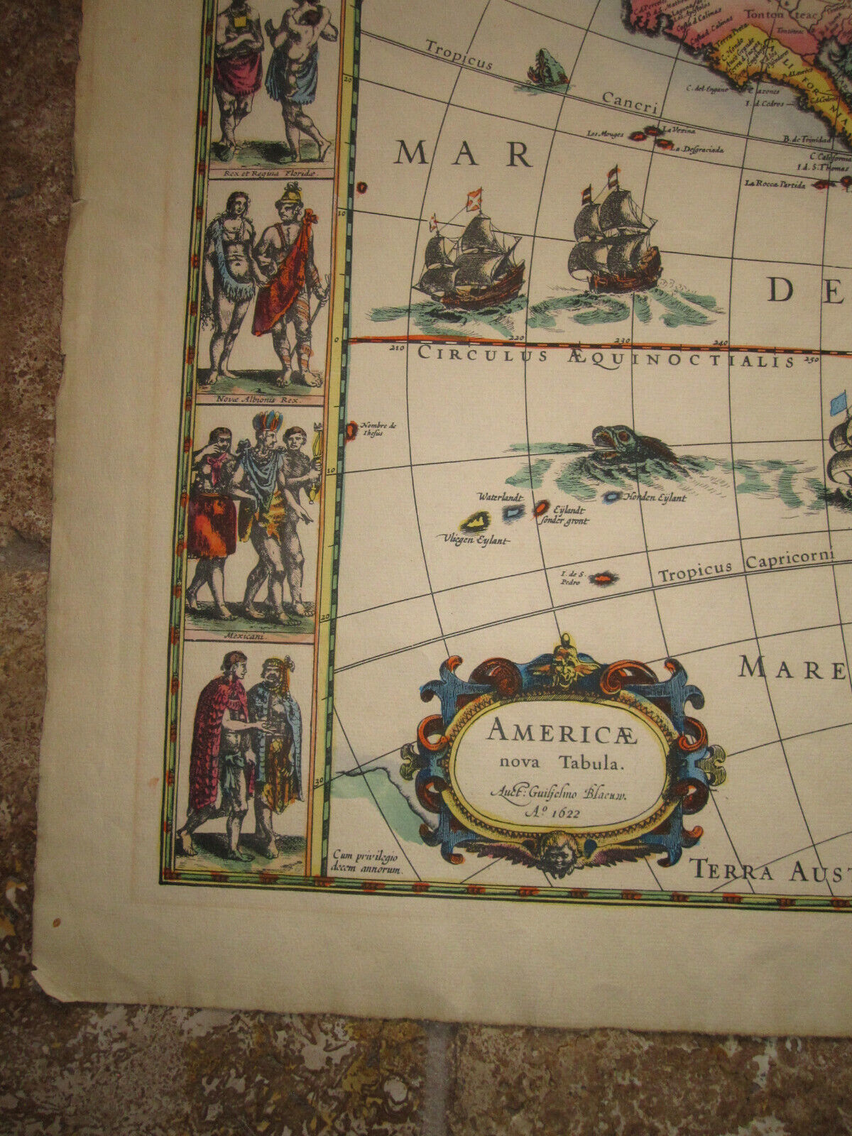
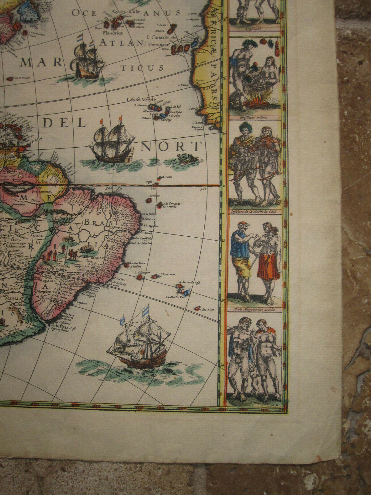
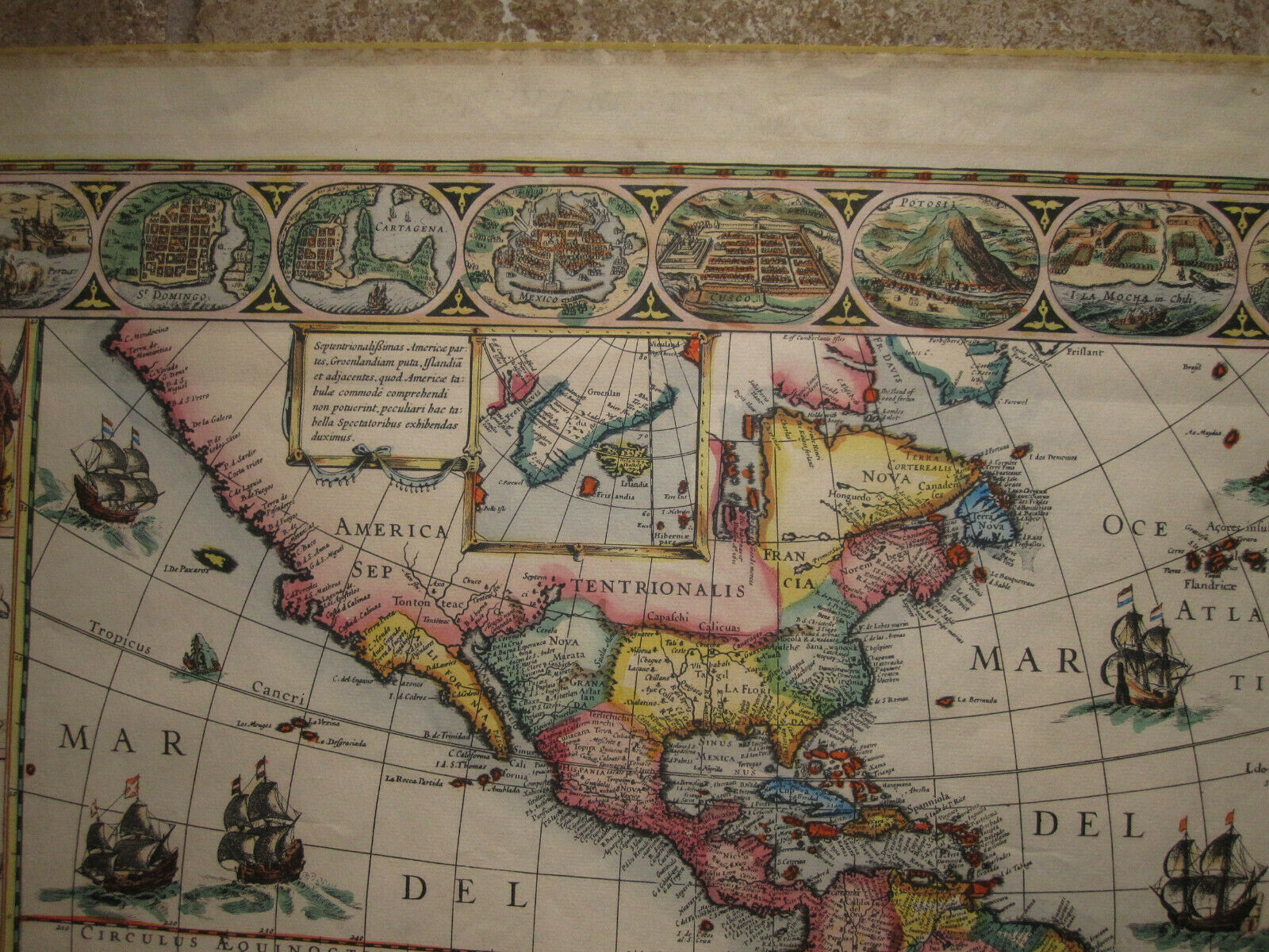
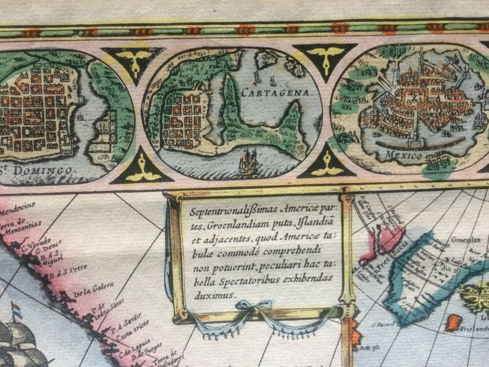
The visual appeal of this map is enhanced greatly by the
inclusion of three decorative borders. The one above contains nine plans or
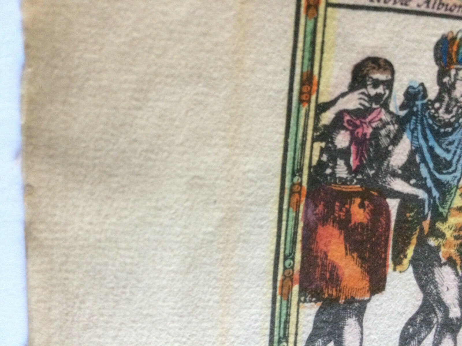
views of towns. The side panels each contain five portraits of figures. It
includes Fretum le Maire and it has the coastline of TERRA AUSTRALIS INCOGNITA removed,
however, mysteriously the name was left behind.
It is a superb antique facsimile of the iconic map complete
with fine art decorative cartography and with ships and sea monsters. Panels at
sides each contain five portraits of figures of the native inhabitants of the
two continents. Across the top are nine town plans including Mexico
City, Havana, Cartegena, and Rio de Janeiro.
A fine example of Blaeu’s iconic map with color and
some light toning. Frayed edges. In good condition. With center fold as issued.
Technique: Copper engraving hand colored on Arches paper.
Blaeu's map of America
is one of the most sought after maps of America from the Golden Age of
Dutch Cartography, blending contemporary geographical knowledge and a rich
decorative image. Blaeu's maps set the standard for the quality of the
engraving, paper and color, as well as a fine depiction of contemporary
geographical knowledge.
This map illustrates excellent detail throughout, including
a classical rendition of the West Coast of America (California is not an island). There are nine
decorative views of important American
Cities and Harbors across
the top and 10 fine miniatures of Native
Americans of various regions along the side panels. The map
is also embellished with eight sailing ships, four sea monsters and vignettes
in the interior of the continent showing Indian life.
There are 5 states of the map, as described by Burden:
State 1: Blaeu uses
the name Guiliel: Janssonius.
No Straits of Le Maire (1617) (2 known examples--British
Library and private collection)
State 2: Straits of
Le Maire added (1618)
State 3: Name changed
to Guiljelmo Blaeuw (1621)
State 4: Engraved
water around the ships and sea monsters in lower right part of map increased
(1642)
State 5: Sea area
re-engraved with harsher straight lines
An essential map for collectors of 17th Century American
maps.
|
Why are we showing these items?
Search Results
Category "North America Maps"
|


-
Refine your browsing experience
We can show you more items that are exactly like the original item, or we can show you items that are similar in spirit. By default we show you a mix.


Este artículo ha sido añadido a su carrito
 Antique Facsimile Hand Colored Engraving of America nova Tabula Guiljelmo Blaeuw added to cart.
Único disponible en stock
Antique Facsimile Hand Colored Engraving of America nova Tabula Guiljelmo Blaeuw added to cart.
Único disponible en stock
Ver el carro o seguir comprando.
 Por favor, espere mientras termine de agregar este artículo a su carrito.
Get an item reminder
We'll email you a link to your item now and follow up with a single reminder (if you'd like one). That's it! No spam, no hassle.
Already have an account?
Log in and add this item to your wish list.