Rendered at 04:06:38 05/25/25
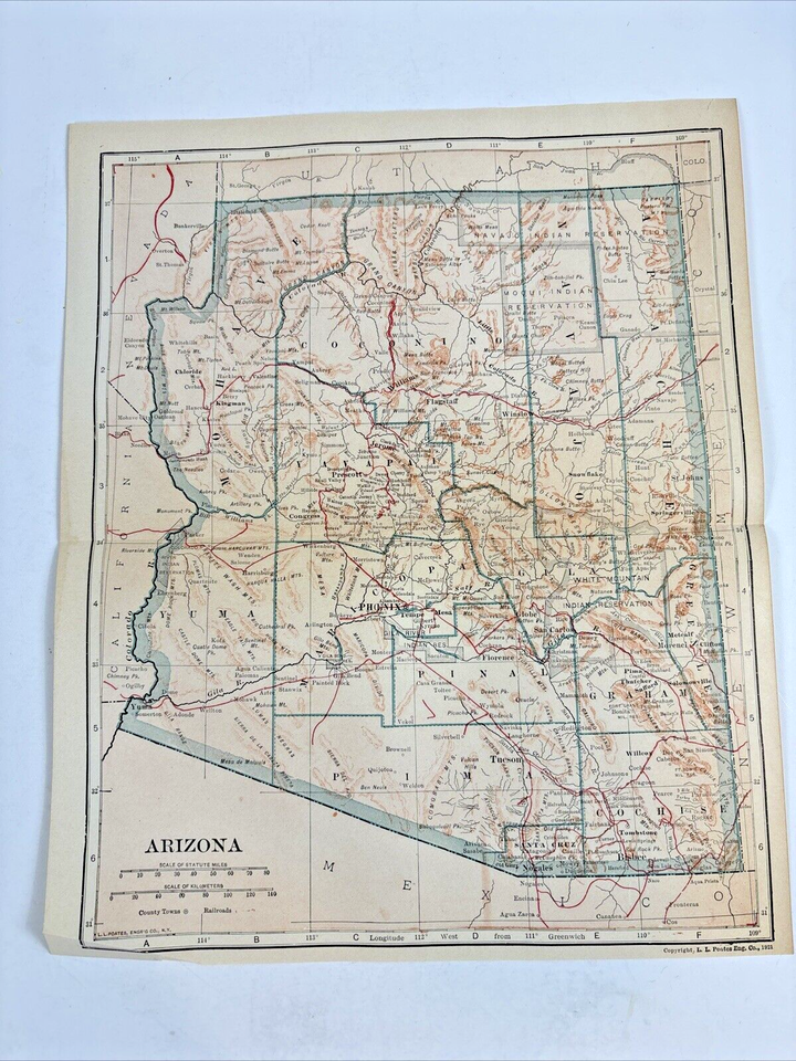


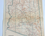
Antique 1921 Arizona Tombstone Cochise State Map for framing and collecting
Los buques de
United States


Las opciones de envío
No hay precio de envío se especifica en MX
Los buques de
United States
Política de oferta
OBO - El vendedor acepta ofertas en este artículo.
Detalles
La política de devoluciones
Protección de compra
Opciones de pago
PayPal accepted
PayPal Credit accepted
Venmo accepted
PayPal, MasterCard, Visa, Discover, and American Express accepted
Maestro accepted
Amazon Pay accepted
Nuvei accepted
Rasgos del artículo
| Categoría: | |
|---|---|
| cantidad disponible: |
Sólo uno en stock, para muy pronto |
| Condition: |
Unspecified by seller, may be new. |
| Type: |
Geological Map |
| Original/Reproduction: |
Antique Original |
| Date Range: |
1920-1929 |
| Year: |
1921 |
| Country/Region: |
United States of America |
| US State: |
Arizona |
| Format: |
Atlas Map |
| Printing Technique: |
Lithography |
| Seller Notes: | |
| Cartographer/Publisher: |
L. L. Poates Engeneering Company |
| City: |
Yuma |
Detalles del anuncio
| Envío de descuento: |
Pesos de envío de todos los elementos se suman para el ahorro. |
|---|---|
| Publicado en venta: |
May 12 |
| Artículo número: |
1746516401 |
Descripción del Artículo
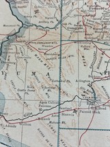
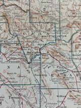
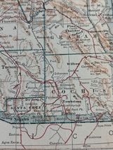
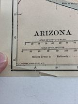
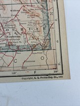
Experience a piece of history with this authentic 1921 Arizona Tombstone and Cochise State Map. Originally printed by the L. L. Poates Engineering Company, this antique lithograph is a true representation of the geological features and territorial boundaries of the time. Ideal for collectors and enthusiasts of historical cartography, this atlas map showcases the intricate details of early 20th-century Wyoming and Arizona.
Whether for framing and display or as an addition to a vintage map collection, this map is a testament to the craftsmanship of the era. Hailing from the United States of America, specifically the city of Yuma, it is a rare original that captures the spirit of the roaring twenties. This map is a window into the past, offering a glimpse of the topography and divisions that shaped the region in the early 1920s.
Added to your wish list!
- Antique 1921 Arizona Tombstone Cochise State Map for framing and collecting
- 1 in stock
- Price negotiable
Get an item reminder
We'll email you a link to your item now and follow up with a single reminder (if you'd like one). That's it! No spam, no hassle.
Already have an account?
Log in and add this item to your wish list.