Rendered at 01:41:08 05/16/25


Envío gratis
HISTORIX 2006 World Map of Volcanoes Earthquakes Impact Craters & Plate Tectonic
$773.55 MXN - $1,160.43 MXN
Los buques de
United States


Las opciones de envío
Los buques de 1 business day Detalles
No hay precio de envío se especifica en MX
Los buques de
United States
La política de devoluciones
Full refund available for DOAs
Detalles
Protección de compra
Opciones de pago
PayPal accepted
PayPal Credit accepted
Venmo accepted
PayPal, MasterCard, Visa, Discover, and American Express accepted
Maestro accepted
Amazon Pay accepted
Nuvei accepted
Rasgos del artículo
| Categoría: | |
|---|---|
| cantidad disponible: |
16 En stock |
| Condition: |
New |
| ASIN: |
B08MDYDW9X |
| Item Name: |
HISTORIX 2006 Map of World Volcanoes |
| manufacturer: |
HISTORIX |
| Item Type Keyword: |
prints |
| Product Site Launch Date: |
2020-11-02T05:08:51.905Z |
| Brand: |
HISTORIX |
| Unspsc Code: |
52140000 |
| sizes: |
Detalles del anuncio
| Las políticas del vendedor: | |
|---|---|
| Envío de descuento: |
Vendedor paga el envío para este artículo. |
| Publicado en venta: |
May 1 |
| Artículo número: |
1743602105 |
Descripción del Artículo
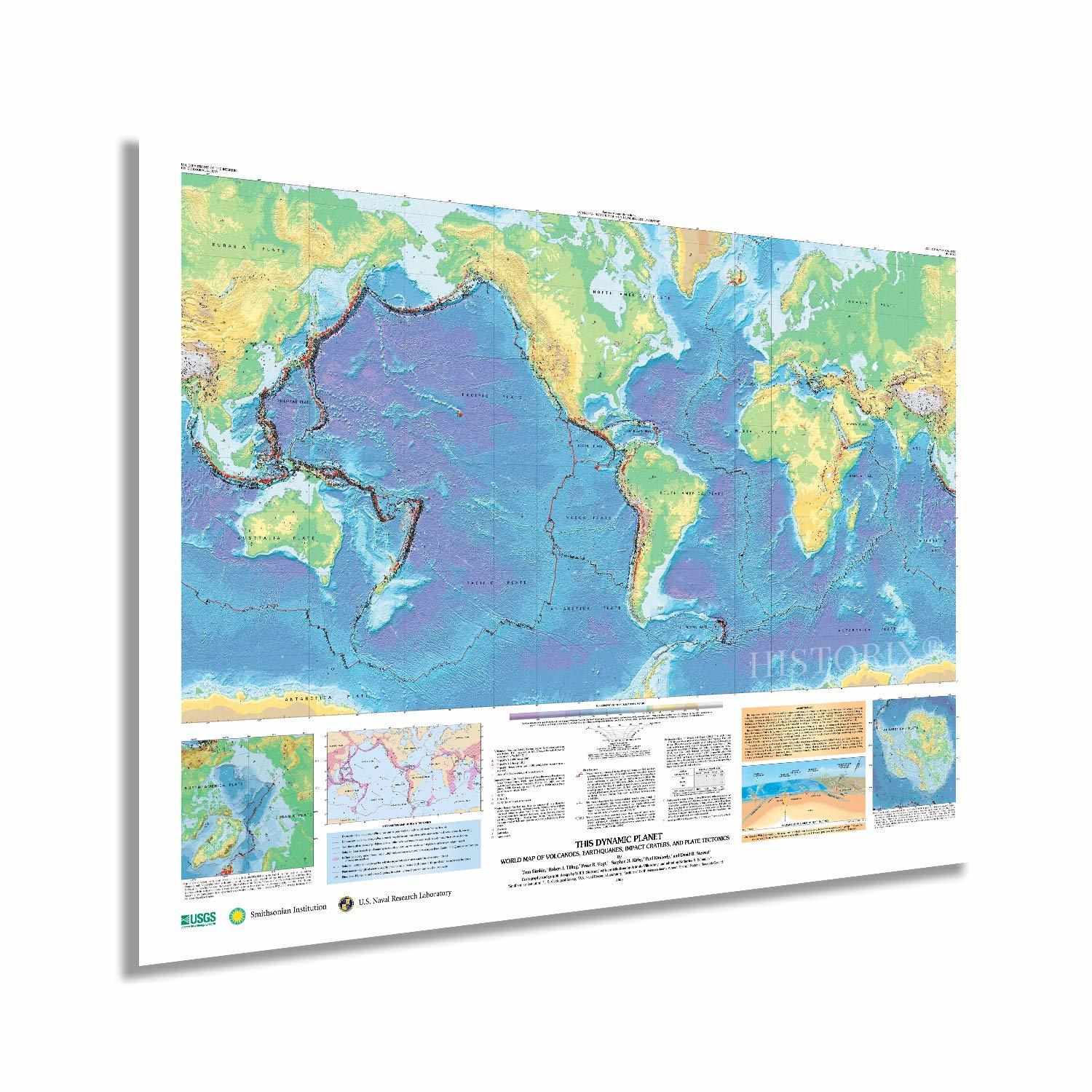
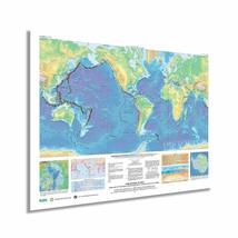
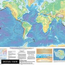
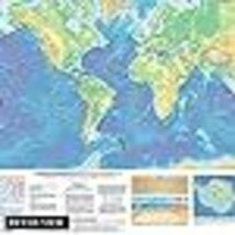
The Earth’s unique geography and topography are continually evolving, and it is a dynamic planet. This detailed map shows over 1,500 volcanoes, 44,000 earthquake locations, and some 170 asteroid impact craters, which have been the primary forces behind the evolution of the Earth’s natural features. This map details the elements that shaped and continue to shape the Earth. Earthquakes and volcanoes are depicted here along the natural faultlines created by the tectonic plates.
Monitoring and recording earthquake and volcanic activity is one of the primary jobs of the US Geological Survey. This snapshot of their data allows the viewer to develop a sense of the scope and magnitude of the Earth’s natural processes of creation. Of the 550 active volcanoes worldwide, some 60 erupt annually, and earthquakes of varying strength have transformed cities and nations throughout history. This illustration creates a visual representation of how the distinct topography we experience came into existence.
Scientists have studied the geological forces behind the Earth’s development for centuries. Maintaining current geological data in a visual form allows for a more thorough understanding of these processes and better prediction modeling. By being able to forecast seismic accurately and volcanic activity, scientists can save lives with evacuation orders. Studying and recording historical data allows them to develop a deeper understanding of when there may be increased activity based on historical information. These maps are evolving as more activity is recorded. These productions stand as a snapshot and are a unique piece of cartographical history.
Our museum quality giclee print comes printed with archival ink on premium heavyweight matte paper. This eye-catching map reproduction print makes the perfect gift for anyone that loves history and imagery.
Added to your wish list!
- HISTORIX 2006 World Map of Volcanoes Earthquakes Impact Craters & Plate Tectonic
- 16 in stock
- Available in multiple sizes
- Handling time 1 day.
- Returns/refunds accepted
Get an item reminder
We'll email you a link to your item now and follow up with a single reminder (if you'd like one). That's it! No spam, no hassle.
Already have an account?
Log in and add this item to your wish list.