Rendered at 15:12:57 05/18/25


Envío gratis
HISTORIX Vintage 1846 Texas Map - 18x24 Inch Texas Vintage Map - Old Poster Map
$779.39 MXN - $1,071.74 MXN
Los buques de
United States


Las opciones de envío
Los buques de 1 business day Detalles
No hay precio de envío se especifica en MX
Los buques de
United States
La política de devoluciones
Full refund available for DOAs
Detalles
Protección de compra
Opciones de pago
PayPal accepted
PayPal Credit accepted
Venmo accepted
PayPal, MasterCard, Visa, Discover, and American Express accepted
Maestro accepted
Amazon Pay accepted
Nuvei accepted
Rasgos del artículo
| Categoría: | |
|---|---|
| cantidad disponible: |
16 En stock |
| Condition: |
New |
| ASIN: |
B09JN4NVWD |
| Item Name: |
1846 Texas |
| Item Type Keyword: |
prints |
| Product Site Launch Date: |
2021-10-17T16:26:38.694Z |
| Unspsc Code: |
60121013 |
| sizes: |
Detalles del anuncio
| Las políticas del vendedor: | |
|---|---|
| Envío de descuento: |
Vendedor paga el envío para este artículo. |
| Publicado en venta: |
May 1 |
| Artículo número: |
1743606032 |
Descripción del Artículo
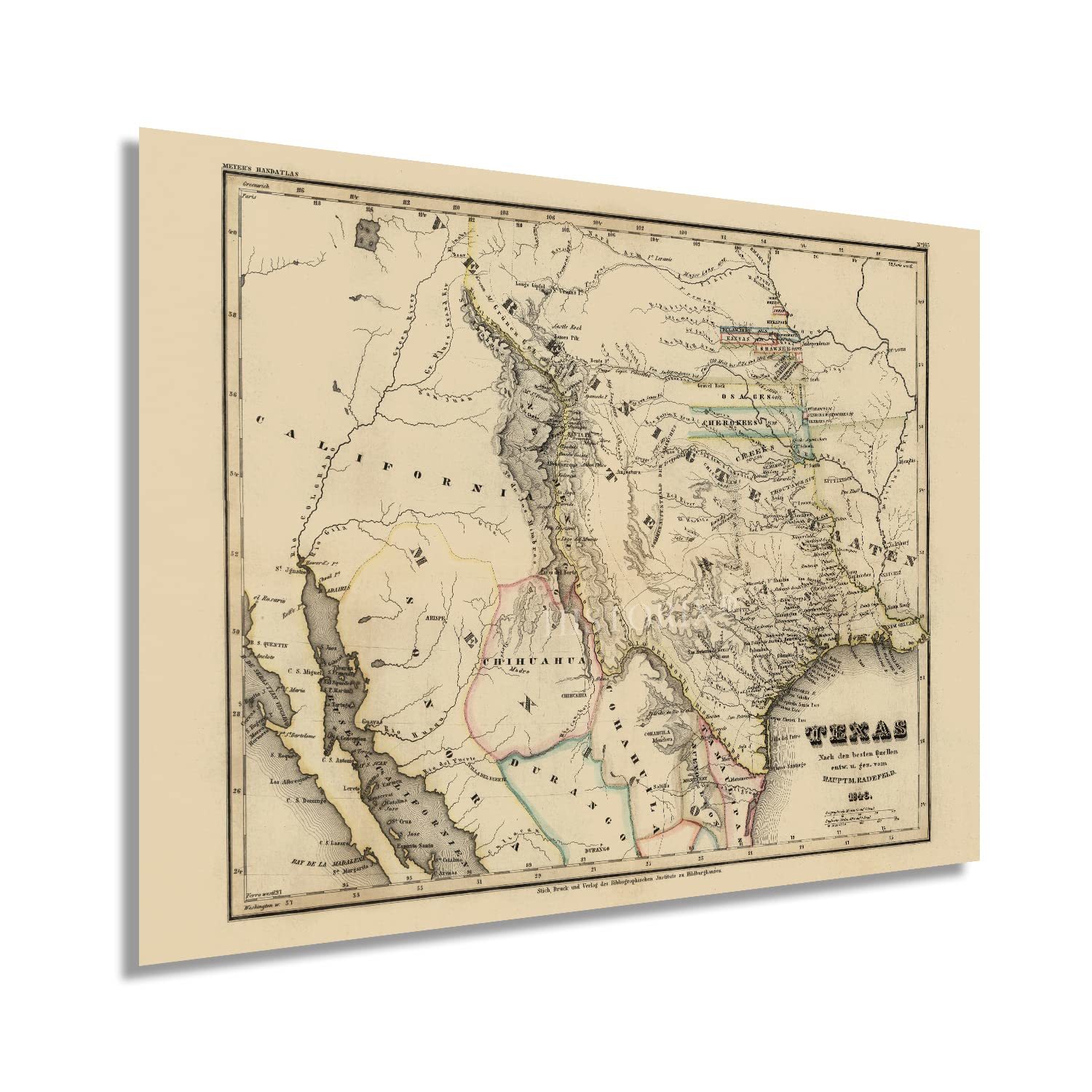
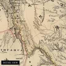
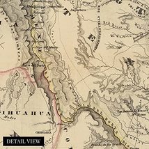
This German-produced map is a rarity of cartographical history as these depictions were generally domestically produced at the time. It was illustrated to promote Texas as a destination for German residents fleeing religious persecution and civil unrest during the middle of the nineteenth century. Another unique quality of this piece is that European maps from this era did not typically publish single states within the United States, instead focusing on depictions of the nation as a whole. The United States annexed Texas in 1845, and the formal transfer of power took place on February 19, 1846.
The annexation caused the outbreak of the Mexican-American war, which lasted two years until concluding with the Treaty of Guadalupe Hidalgo in 1848. This period saw significant growth and immigration throughout the state, with German residents establishing numerous communities throughout the central Texas Hill Country. Many of these buildings exist to this day, and communities established along cultural lines still thrive. Cities like New Braunfels and Fredericksburg still feature a heavy German influence in architecture and city halls which were primarily established in the mid-nineteenth century.
As the influx of German immigrants to the region continued, many mills, beer gardens, and other establishments sprung up on the banks of the Guadalupe, Comal, and Blanco rivers, some of which are still in operation to this day. This work's unique style and distinctive aesthetic immediately transport the viewer back in time, and this is an authentic piece of Texan cartographical history.
Our museum quality giclee print comes printed with archival ink on premium heavyweight matte paper. Shipped in a sturdy cardboard tube your print will arrive ready to be framed. This eye-catching vintage map reproduction print makes the perfect gift for anyone that loves history and imagery.
Added to your wish list!

- HISTORIX Vintage 1846 Texas Map - 18x24 Inch Texas Vintage Map - Old Poster Map
- 16 in stock
- Available in multiple sizes
- Handling time 1 day.
- Returns/refunds accepted
Get an item reminder
We'll email you a link to your item now and follow up with a single reminder (if you'd like one). That's it! No spam, no hassle.
Already have an account?
Log in and add this item to your wish list.