Rendered at 09:55:38 05/18/25


Envío gratis
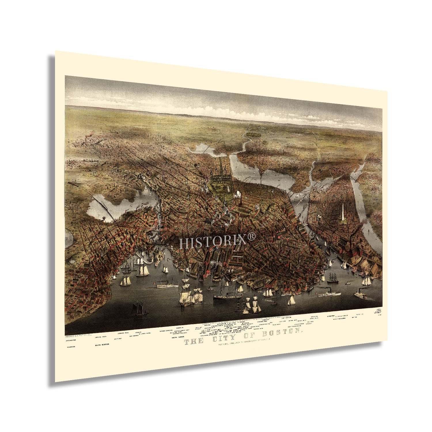
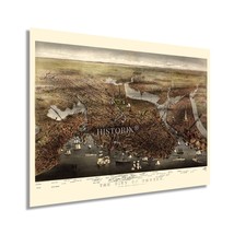
HISTORIX Vintage 1873 Boston Massachusetts Map - 18x24 Inch Old Boston Map of Ma
$779.39 MXN - $1,169.19 MXN
Los buques de
United States


Las opciones de envío
Los buques de 1 business day Detalles
No hay precio de envío se especifica en MX
Los buques de
United States
La política de devoluciones
Full refund available for DOAs
Detalles
Protección de compra
Opciones de pago
PayPal accepted
PayPal Credit accepted
Venmo accepted
PayPal, MasterCard, Visa, Discover, and American Express accepted
Maestro accepted
Amazon Pay accepted
Nuvei accepted
Rasgos del artículo
| Categoría: | |
|---|---|
| cantidad disponible: |
16 En stock |
| Condition: |
New |
| UPC: |
737214980308 |
| Item Name: |
1873 Boston Massachusetts Poster Print |
| Item Type Keyword: |
prints |
| sizes: |
Detalles del anuncio
| Las políticas del vendedor: | |
|---|---|
| Envío de descuento: |
Vendedor paga el envío para este artículo. |
| Publicado en venta: |
May 1 |
| Artículo número: |
1743606928 |
Descripción del Artículo
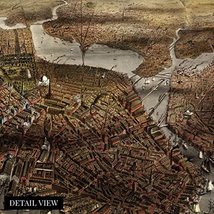
One of the oldest municipalities in the United States, Boston remains an enduring and iconic city with a history that is irrefutably intertwined with the United States as a whole. From the first establishment of English Colonies in North America, the Boston area became a hotbed of Revolutionary thought during the American Revolution and would become a critical city following the conclusion of the War for Independence. The city was home to numerous significant turning points during the American Revolution, including the Boston Tea Party, Boston Massacre, Battle of Bunker Hill, and the siege of Boston.
This birds-eye perspective was produced and published by one of the most prolific printing houses in the United States, Currier Ives, who produced more than seventy-five hundred images throughout the nineteenth and early twentieth centuries. Panoramic maps served as marketing materials to promote prominent civic features, religious, cultural, and educational institutions, as well as economic opportunities. Immigrants flocked to Boston throughout its rich history. The city maintains many Irish, Italian, and Eastern European communities and neighborhoods established along cultural lines, many of which exist to this day. These productions were widely popular until the 1920s, when technological advances in aerial photography made them obsolete.
This is an authentic piece of American cartographical that bears a unique aesthetic and distinctive style that immediately transports the viewer back in time, creating an indelible bond between the past and present. This map captures a period of prosperity and growth for one of America’s most emblematic cities.
Our museum quality giclee print comes printed with archival ink on premium heavyweight matte paper. Shipped in a sturdy cardboard tube your print will arrive ready to be framed. This eye-catching vintage print makes the perfect gift for anyone that loves history and imagery.
Added to your wish list!
- HISTORIX Vintage 1873 Boston Massachusetts Map - 18x24 Inch Old Boston Map of Ma
- 16 in stock
- Available in multiple sizes
- Handling time 1 day.
- Returns/refunds accepted
Get an item reminder
We'll email you a link to your item now and follow up with a single reminder (if you'd like one). That's it! No spam, no hassle.
Already have an account?
Log in and add this item to your wish list.