Rendered at 12:36:02 05/18/25


Envío gratis
HISTORIX Vintage 1895 Saint Louis Missouri Map - 18x24 Inch Vintage Map of St Lo
$779.39 MXN - $1,169.19 MXN
Los buques de
United States


Las opciones de envío
Los buques de 1 business day Detalles
No hay precio de envío se especifica en MX
Los buques de
United States
La política de devoluciones
Full refund available for DOAs
Detalles
Protección de compra
Opciones de pago
PayPal accepted
PayPal Credit accepted
Venmo accepted
PayPal, MasterCard, Visa, Discover, and American Express accepted
Maestro accepted
Amazon Pay accepted
Nuvei accepted
Rasgos del artículo
| Categoría: | |
|---|---|
| cantidad disponible: |
16 En stock |
| Condition: |
New |
| ASIN: |
B08M6CQK32 |
| Item Name: |
HISTORIX 1895 St Louis Missouri |
| manufacturer: |
HISTORIX |
| Item Type Keyword: |
prints |
| Product Site Launch Date: |
2020-10-29T15:42:26.933Z |
| Brand: |
HISTORIX |
| Unspsc Code: |
52140000 |
| sizes: |
Detalles del anuncio
| Las políticas del vendedor: | |
|---|---|
| Envío de descuento: |
Vendedor paga el envío para este artículo. |
| Publicado en venta: |
May 1 |
| Artículo número: |
1743603963 |
Descripción del Artículo
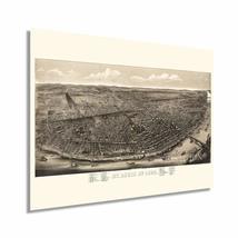
This detailed portrayal of St. Louis depicts the city in a time of significant prosperity, growth, and transformation. By the end of the nineteenth century St. Louis had become the fourth largest American city and was thriving economically. The city was experiencing massive cultural evolution and becoming one of the jewels of the American midwest. It had the nation’s tallest skyscraper constructed in 1891 and was as culturally significant as any American city at the time. Extensive railroad lines and St fueled the rapid westward expansion, and St. Louis was one of the largest hubs allowing travel throughout the nation to go through the city.
Produced in the distinctive Birds Eye perspective by noted lithographer Charles Juehne, a popular illustration style in the latter portions of the nineteenth century, this stunning map immediately transports the viewer back in time and creates a unique link between past and present. Birds Eye perspectives were produced as marketing materials for prominent cities and would detail notable businesses, civil buildings, and other enticing features.
St. Louis had seen industrialization like no other city following the Civil War's conclusion in 1865, and vast fortunes were being made in manufacturing plants. This created a population explosion as eager Southern Americans flocked to the city for employment. Additionally, its location at the Ohio, Mississippi, and Missouri rivers' confluence made it uniquely suited for inter-regional trade. Publish during a significant period in St. Louis’ evolution; this is truly an authentic piece of Americana cartographical history.
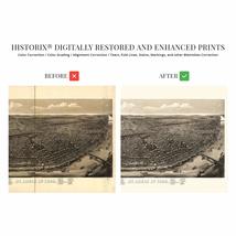
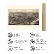
Our museum quality giclee print comes printed with archival ink on premium heavyweight matte paper. Shipped in a sturdy cardboard tube your print will arrive ready to be framed. This eye-catching vintage map reproduction print makes the perfect gift for anyone that loves history and imagery.
Added to your wish list!
- HISTORIX Vintage 1895 Saint Louis Missouri Map - 18x24 Inch Vintage Map of St Lo
- 16 in stock
- Available in multiple sizes
- Handling time 1 day.
- Returns/refunds accepted
Get an item reminder
We'll email you a link to your item now and follow up with a single reminder (if you'd like one). That's it! No spam, no hassle.
Already have an account?
Log in and add this item to your wish list.