Rendered at 00:33:48 08/03/25
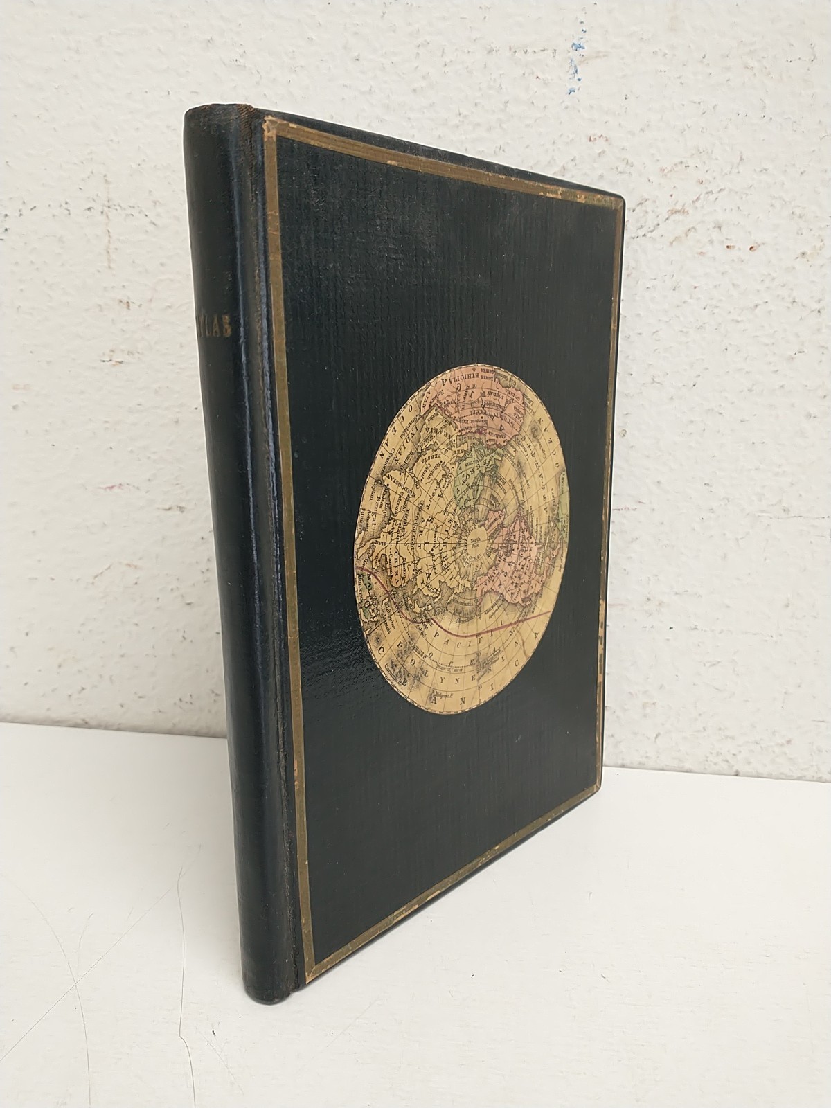


Hammond's Little Giant Atlas of the World 1926 Full Color Maps Index Population
Los buques de
United States

Las opciones de envío
No hay precio de envío se especifica en MX
Los buques de
United States
Política de oferta
OBO - El vendedor acepta ofertas en este artículo.
Detalles
La política de devoluciones
Protección de compra
Opciones de pago
PayPal accepted
PayPal Credit accepted
Venmo accepted
PayPal, MasterCard, Visa, Discover, and American Express accepted
Maestro accepted
Amazon Pay accepted
Nuvei accepted
Rasgos del artículo
| Categoría: | |
|---|---|
| cantidad disponible: |
Sólo uno en stock, para muy pronto |
| Condition: |
Unspecified by seller, may be new. |
| Binding: |
Softcover, Wraps |
| ISBN: |
Does not apply |
| Topic: |
Reference Atlases |
| Year Printed: |
1926 |
| Country/Region of Manufacture: |
United States |
| Language: |
English |
| Place of Publication: |
nY |
| Subject: |
Reference |
| Signed: |
No |
| Publisher: |
CS Hammond & Company |
| Special Attributes: |
colored maps |
| Author: |
CS hammond & co |
| Character Family: |
world atlas |
Detalles del anuncio
| Envío de descuento: |
Pesos de envío de todos los elementos se suman para el ahorro. |
|---|---|
| Publicado en venta: |
Más de una semana |
| Artículo número: |
1740705953 |
Descripción del Artículo
Offered here is a 1926 edition of Hammond's Little Giant Atlas of the World, a compact yet richly detailed reference packed with full-color maps, comprehensive indexing, and population data from the early 20th century. Published by C.S. Hammond Company, this atlas offers a fascinating snapshot of global geography in the post?World War I era. Featuring maps of countries, continents, and U.S. states, it also includes statistics and political boundaries reflective of the period?s geopolitical landscape.
This vintage atlas is a valuable resource for collectors of historical cartography, educators, or those with an interest in early 20th-century world affairs. Its colorful lithographed maps and informative annotations provide a vivid look at how the world was seen nearly a century ago. Whether for research, display, or appreciation of antique mapmaking, this volume offers both charm and insight into a bygone global order.
Pre-Owned. See photos for condition. Ships via USPS Media Mail. Please message with any questions. We ship Monday-Friday.
Added to your wish list!

- Hammond's Little Giant Atlas of the World 1926 Full Color Maps Index Population
- 1 in stock
- Price negotiable
Get an item reminder
We'll email you a link to your item now and follow up with a single reminder (if you'd like one). That's it! No spam, no hassle.
Already have an account?
Log in and add this item to your wish list.