Rendered at 16:05:07 05/23/25

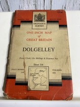
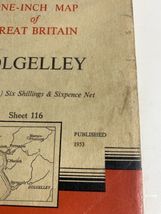
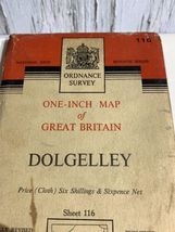
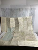
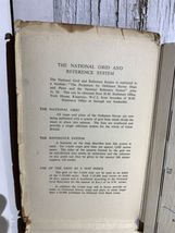

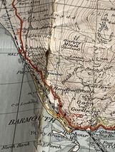

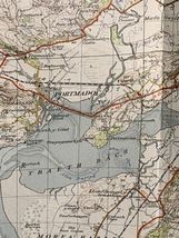
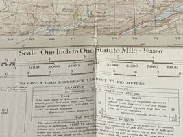


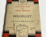
Ordnance Survey One Inch Map of Great Britain Dolgelley Sheet 116 Cloth map
Los buques de
United States


Las opciones de envío
Política de oferta
OBO - El vendedor acepta ofertas en este artículo.
Detalles
La política de devoluciones
None: All purchases final
Protección de compra
Opciones de pago
PayPal accepted
PayPal Credit accepted
Venmo accepted
PayPal, MasterCard, Visa, Discover, and American Express accepted
Maestro accepted
Amazon Pay accepted
Nuvei accepted
Rasgos del artículo
| Categoría: | |
|---|---|
| cantidad disponible: |
Sólo uno en stock, para muy pronto |
| Condition: |
Unspecified by seller, may be new. |
| Type: |
Ordnance Survey Map |
| Original/Reproduction: |
Vintage Original |
| Date Range: |
1950-1959 |
| Year: |
1959 |
| Country/Region: |
England |
| Format: |
Folding Map |
| Cartographer/Publisher: |
National Grid |
| City: |
Dolgelley |
| County: |
Dolgelley |
Detalles del anuncio
| Envío de descuento: |
No ofrece el envío combinado |
|---|---|
| Publicado en venta: |
Más de una semana |
| Artículo número: |
1735419788 |
Descripción del Artículo
Ordnance Survey One Inch Map of Great Britain Dolgelley Sheet 116 Cloth
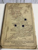
Well used Vintage cloth map. Has marks and some staining and a few holes where the maps crease fold . Would look great framed
Added to your wish list!
- Ordnance Survey One Inch Map of Great Britain Dolgelley Sheet 116 Cloth map
- 1 in stock
- Price negotiable
- Handling time 2 day.
Get an item reminder
We'll email you a link to your item now and follow up with a single reminder (if you'd like one). That's it! No spam, no hassle.
Already have an account?
Log in and add this item to your wish list.