Rendered at 20:55:12 10/15/25


Sign up and get $15.00 bCredits free to use at checkout and another $5.00 bCredits when you make your first purchase. More info
Envío gratis
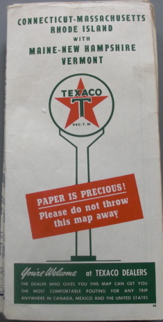
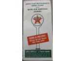
Texaco Touring Map of Connecticut-Massachusets Rhode Island with Maine-New Hamps
$353.46 MXN
Sign up and get $15.00 bCredits free to use at checkout and another $5.00 bCredits when you make your first purchase. More info
Los buques de
United States

Share & earn! Sign in, share this or any listing, and you’ll get commission when it sells.
Learn more
Las opciones de envío
No hay precio de envío se especifica en MX
Los buques de
United States
La política de devoluciones
Protección de compra
Opciones de pago
PayPal accepted
PayPal Credit accepted
Venmo accepted
PayPal, MasterCard, Visa, Discover, and American Express accepted
Maestro accepted
Amazon Pay accepted
Nuvei accepted
Rasgos del artículo
| Categoría: | |
|---|---|
| cantidad disponible: |
Sólo uno en stock, para muy pronto |
| Condition: |
Used |
| Country: |
United States |
| Country/Region of Manufacture: |
United States |
| Publication Date: |
1940 |
Detalles del anuncio
| Envío de descuento: |
Vendedor paga el envío para este artículo. |
|---|---|
| Precio de descuento: |
10% De descuento w / $100.00 pasó |
| Publicado en venta: |
Más de una semana |
| Artículo número: |
1743435248 |
Descripción del Artículo
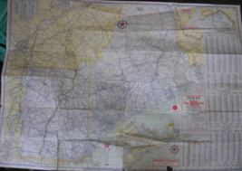
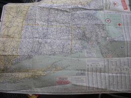
Texaco Touring Map of Connecticut-Massachusets Rhode Island with Maine-New Hampshire and Vermont. C. 1940 and printed by Rand McNally Company, Chicago, Ill.
Clean and crisp, minimal tare on one edge. Excellent condition. Lots of information on the map, populations of cities, reading road signs, etc
Added to your wish list!
Get an item reminder
We'll email you a link to your item now and follow up with a single reminder (if you'd like one). That's it! No spam, no hassle.
Already have an account?
Log in and add this item to your wish list.