Rendered at 22:37:36 06/08/25
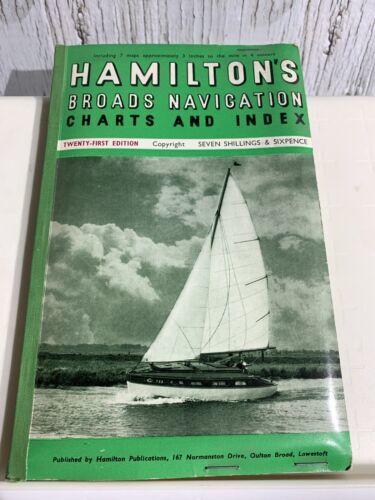
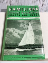

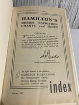


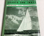
UK Hamilton's Broads Maritime Navigation 2 Chart and Index 21st Edition 1967
Los buques de
United States


Las opciones de envío
Política de oferta
OBO - El vendedor acepta ofertas en este artículo.
Detalles
La política de devoluciones
None: All purchases final
Protección de compra
Opciones de pago
PayPal accepted
PayPal Credit accepted
Venmo accepted
PayPal, MasterCard, Visa, Discover, and American Express accepted
Maestro accepted
Amazon Pay accepted
Nuvei accepted
Rasgos del artículo
| Categoría: | |
|---|---|
| cantidad disponible: |
Sólo uno en stock, para muy pronto |
| Condition: |
Unspecified by seller, may be new. |
| Maker: |
Hamilton Publications |
| Country/Region of Origin: |
United Kingdom |
| Original/Reproduction: |
Vintage Original |
| Time Period, War: |
1967 |
Detalles del anuncio
| Envío de descuento: |
No ofrece el envío combinado |
|---|---|
| Publicado en venta: |
Más de una semana |
| Artículo número: |
1741512630 |
Descripción del Artículo
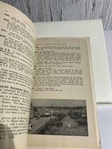
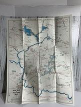
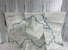
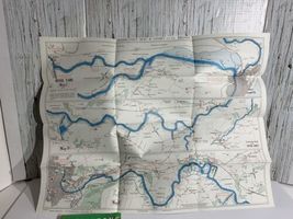
UK Hamilton's Broads Maritime Navigation 2 Double Sided Chart or Map River Waveney, Yare, Chet, Bure, Thurne, Ant Map A,B, C, D, E, F, G and Index 21st Edition 1967Vintage book and charts. The book pages are yellowed. The Navigation Maps or Charts are folded and in very nice condition. Your getting (2) Double sided Maritime map which would look great in a frame. (1) Index booklet Ships from smoke free home
Added to your wish list!
- UK Hamilton's Broads Maritime Navigation 2 Chart and Index 21st Edition 1967
- 1 in stock
- Price negotiable
- Handling time 2 day.
Get an item reminder
We'll email you a link to your item now and follow up with a single reminder (if you'd like one). That's it! No spam, no hassle.
Already have an account?
Log in and add this item to your wish list.