Rendered at 00:59:16 06/27/25


 City Map 1968")
 City Map 1968")
 City Map 1968")
 City Map 1968")
 City Map 1968")
 City Map 1968")
 City Map 1968")
 City Map 1968")
 City Map 1968")
 City Map 1968")
 City Map 1968")
 City Map 1968")
 City Map 1968")
 City Map 1968")
Envío gratis
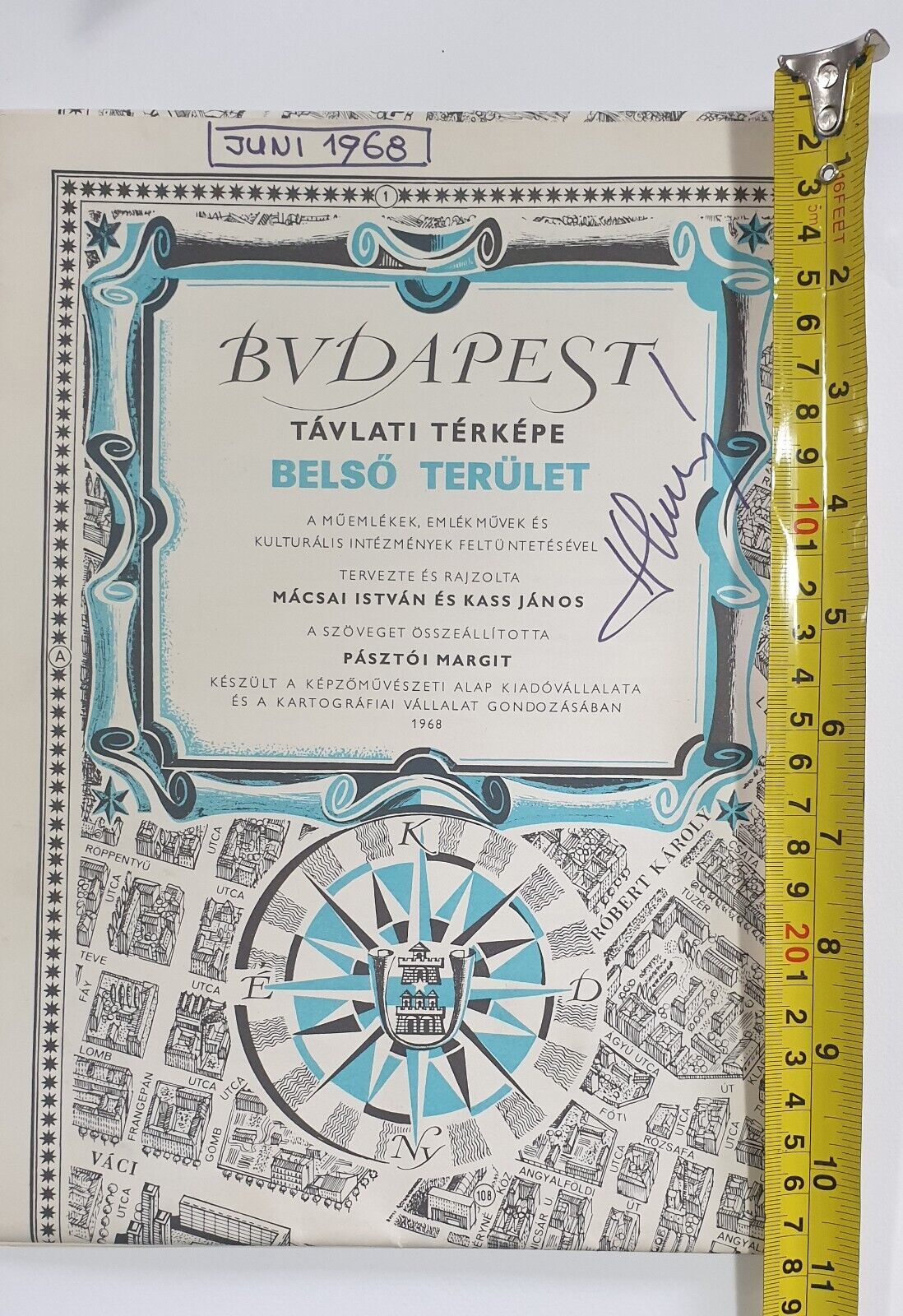
Vintage Touristic Artistic Illustrated Budapest (Hungary) City Map 1968
Los buques de
Bosnia and Herzegovina


Las opciones de envío
GRATIS a Worldwide
Los buques de
Bosnia and Herzegovina
Política de oferta
OBO - El vendedor acepta ofertas en este artículo.
Detalles
La política de devoluciones
Protección de compra
Opciones de pago
PayPal accepted
PayPal Credit accepted
Venmo accepted
PayPal, MasterCard, Visa, Discover, and American Express accepted
Maestro accepted
Amazon Pay accepted
Nuvei accepted
Rasgos del artículo
| Categoría: | |
|---|---|
| cantidad disponible: |
Sólo uno en stock, para muy pronto |
| Condition: |
Used |
| Country/Region of Manufacture: |
Hungary |
| Seller Notes: |
“Has some writing on 3 places, apart of that condition is great.” |
| Year: |
1968 |
| Region: |
Europe |
Detalles del anuncio
| Envío de descuento: |
Vendedor paga el envío para este artículo. |
|---|---|
| Publicado en venta: |
Más de una semana |
| Artículo número: |
1535348940 |
Descripción del Artículo
Vintage Foldable Touristic Artistic Illustrated Budapest (Hungary) City Map
The map is detailed illustrated as a master piece.
The piece was drawn 1963 by Hungarian artists: Istvan Macsai and Janos Kass
Publishing house: Publishing House of The Art Foundation and Cartography Institute of Budapest
Printed 1968
Edition 2
Front side- illustration; back side - listed streets sites; 3 languages (Hungarian, German and English
Dimension folded: 29x20cm
Dimension unfolded: 117x81cm (pretty huge for a map)
Fantastic piece of art for the wall :)
NOTE: Has some writing on 3 places (not much relevant for the overall map), apart of that condition is great. Please see the photos.
Added to your wish list!

- Vintage Touristic Artistic Illustrated Budapest (Hungary) City Map 1968
- 1 in stock
- Price negotiable
Get an item reminder
We'll email you a link to your item now and follow up with a single reminder (if you'd like one). That's it! No spam, no hassle.
Already have an account?
Log in and add this item to your wish list.