Rendered at 00:06:38 11/13/25


Sign up and get $5.00 bCredits free to use at checkout and another $5.00 bCredits when you make your first purchase. More info


WILKINSON, ATLAS CLASSICA, 2nd ed. 1808 - 53 Handcolored Maps and Charts
$11,019.36 MXN
(It may be possible to pay only $585.00 instead of $600.00 when you
use your bCredits at checkout)
Sign up and get $5.00 bCredits free to use at checkout and another $5.00 bCredits when you make your first purchase. More info
Los buques de
United States

Share & earn! Sign in, share this or any listing, and you’ll get commission when it sells.
Learn more

Las opciones de envío
Los buques de 2 business days Detalles
No hay precio de envío se especifica en MX
Los buques de
United States
Política de oferta
OBO - El vendedor acepta ofertas en este artículo.
Detalles
La política de devoluciones
Full refund available within 30 days
Protección de compra
Opciones de pago
PayPal accepted
PayPal Credit accepted
Venmo accepted
PayPal, MasterCard, Visa, Discover, and American Express accepted
Maestro accepted
Amazon Pay accepted
Nuvei accepted
Rasgos del artículo
| Categoría: | |
|---|---|
| cantidad disponible: |
Sólo uno en stock, para muy pronto |
| Condition: |
Unspecified by seller, may be new. |
| Binding: |
Hardcover |
| Topic: |
Reference Atlases |
| Year Printed: |
1808 |
| Country/Region of Manufacture: |
United States |
| Region: |
Europe |
| Language: |
English |
| Original/Facsimile: |
Original |
| Place of Publication: |
London |
| Author: |
Robert Wilkinson Compiler |
| Publisher: |
Wilkinson, Robert |
| Modified Item: |
No |
| Subject: |
Biblical and Classic Literature Maps |
Detalles del anuncio
| Las políticas del vendedor: | |
|---|---|
| Envío de descuento: |
No ofrece el envío combinado |
| Publicado en venta: |
Más de una semana |
| Artículo número: |
1648331264 |
Descripción del Artículo
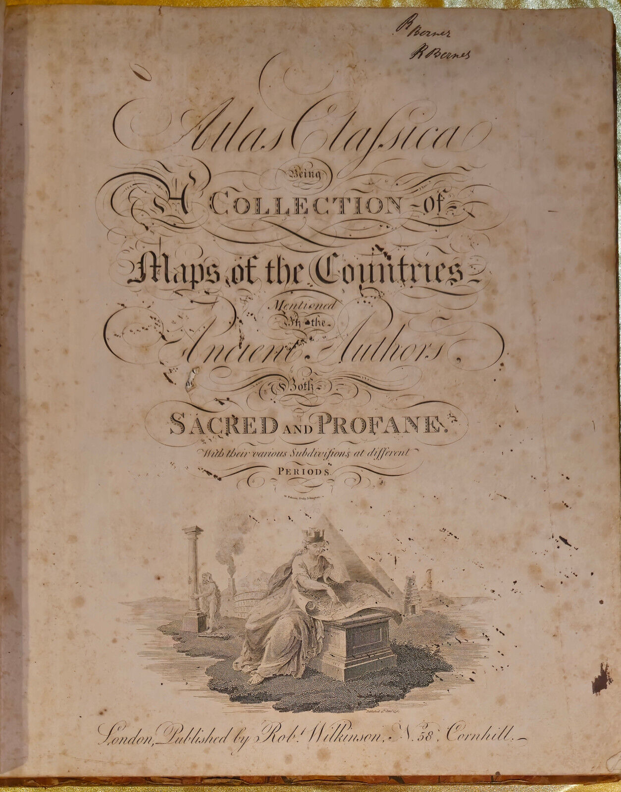
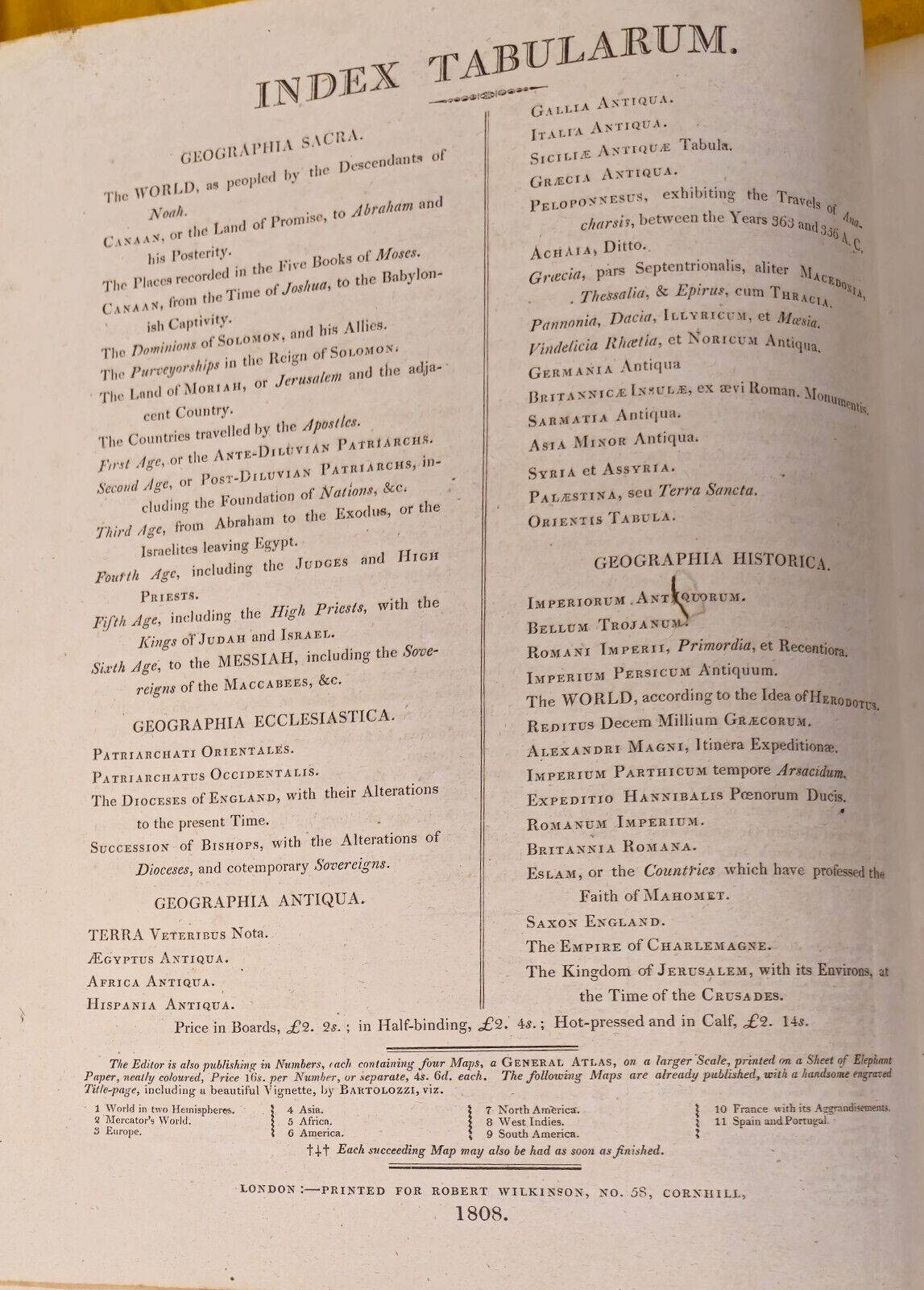
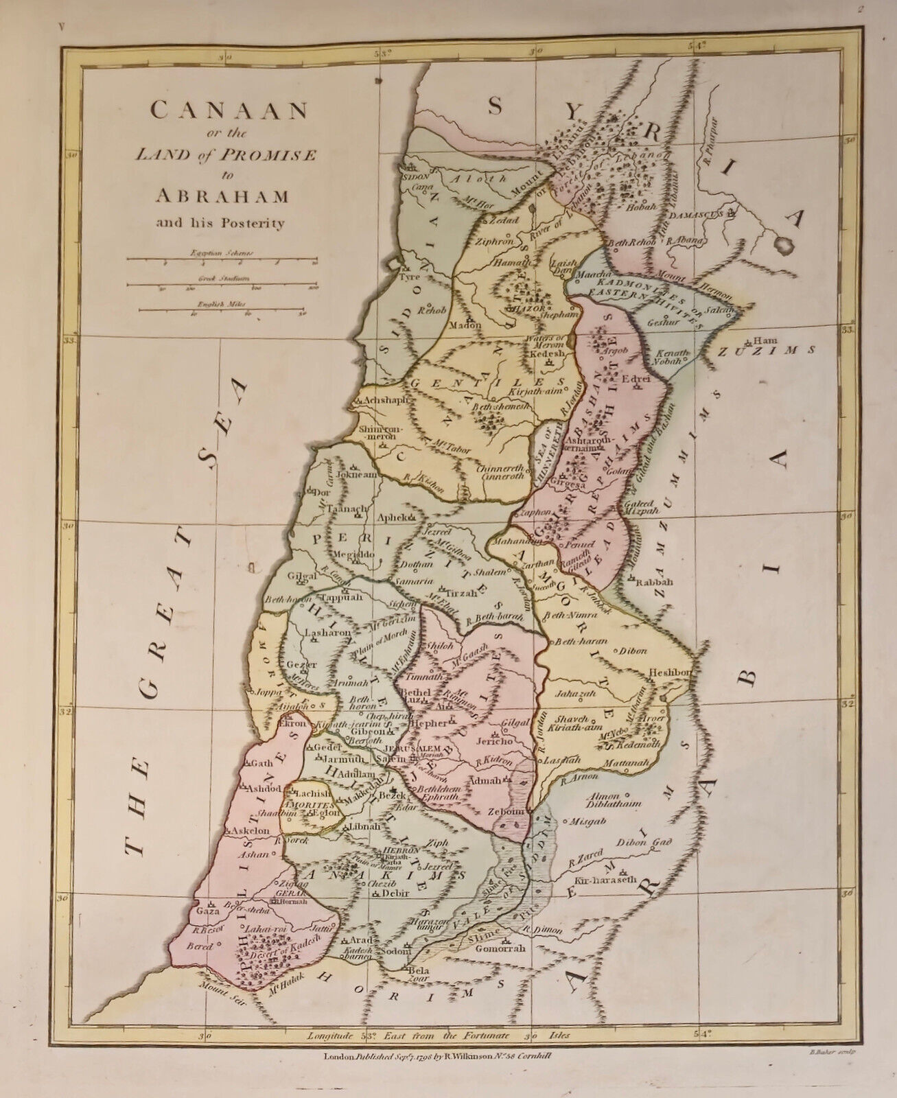
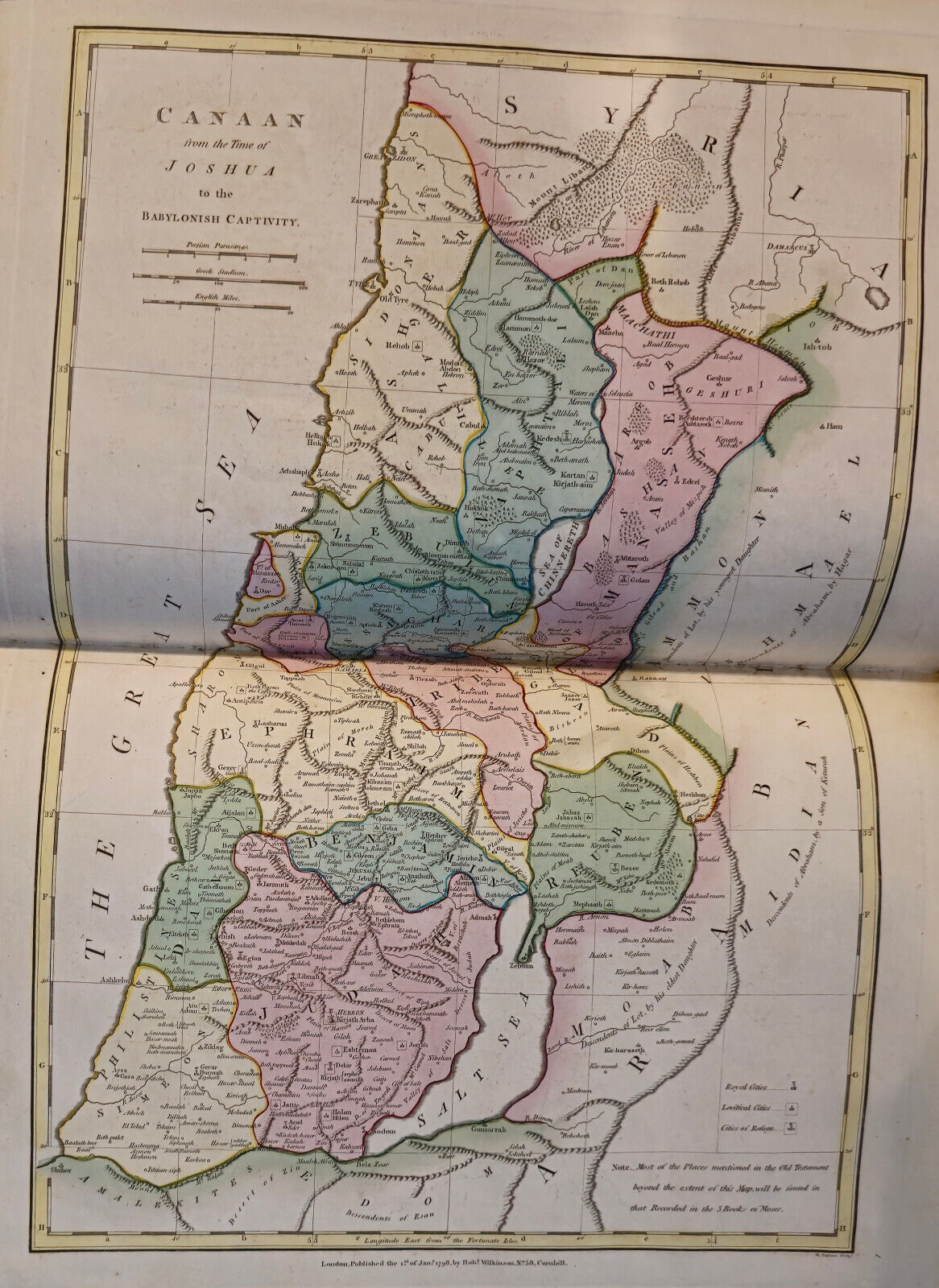
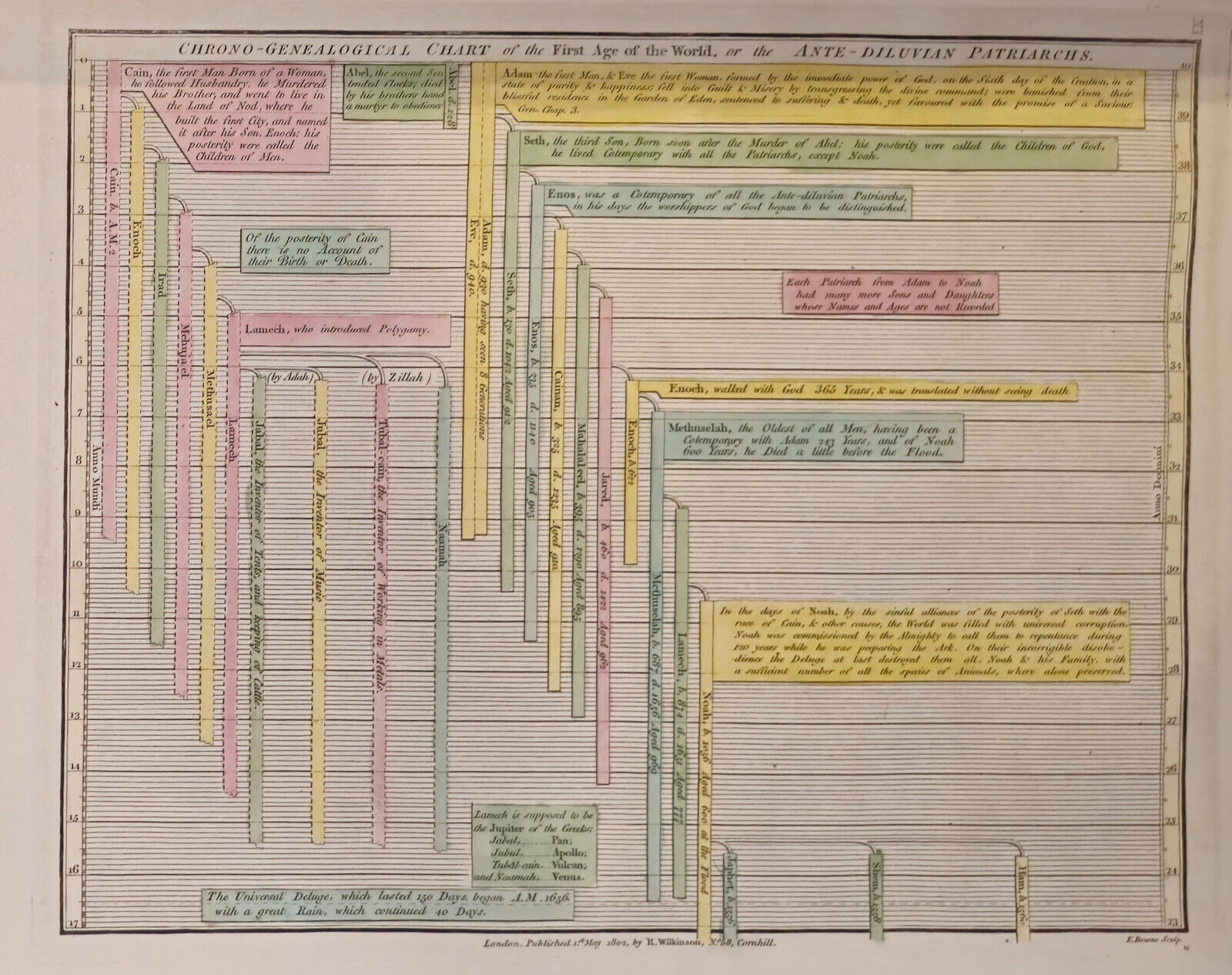
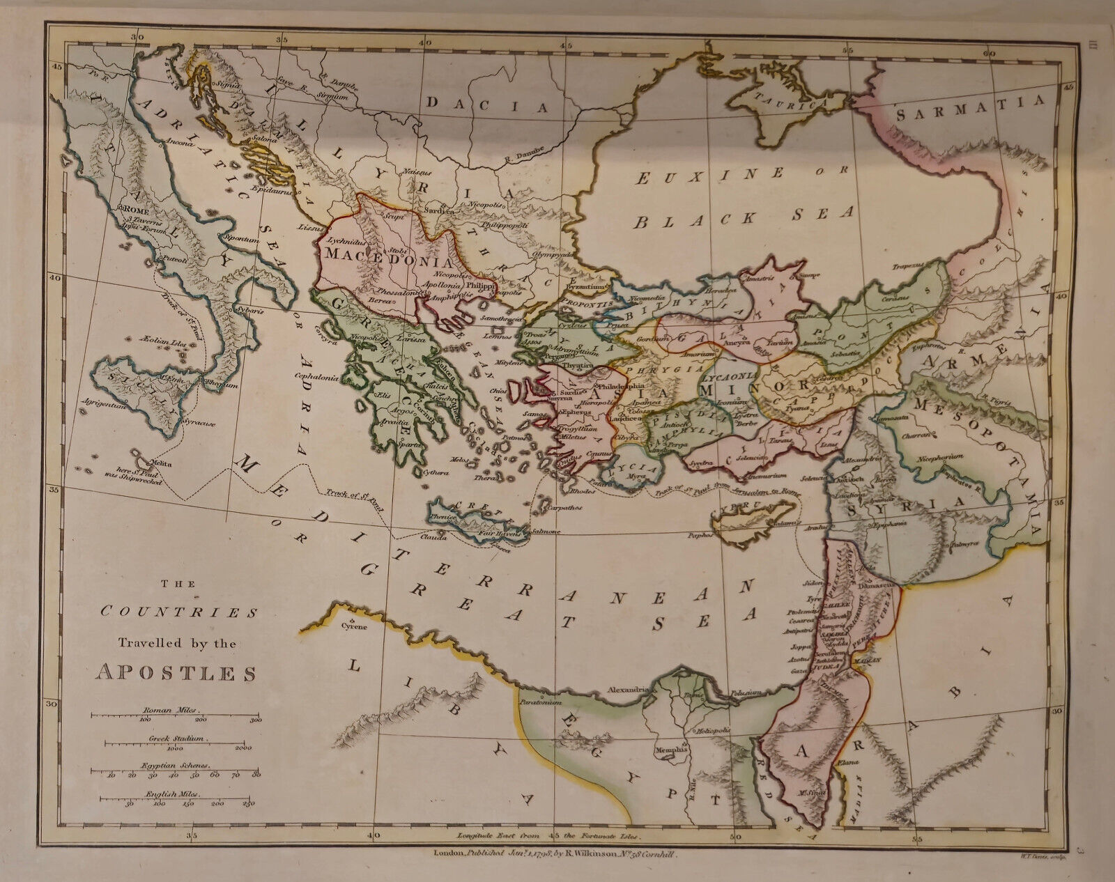
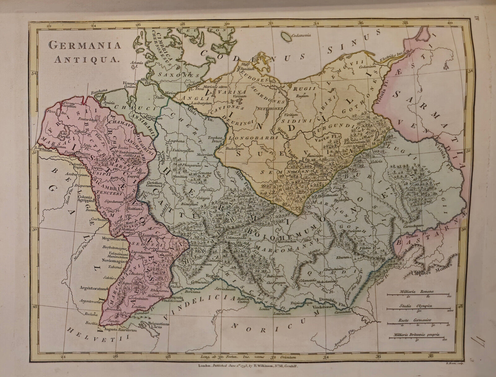
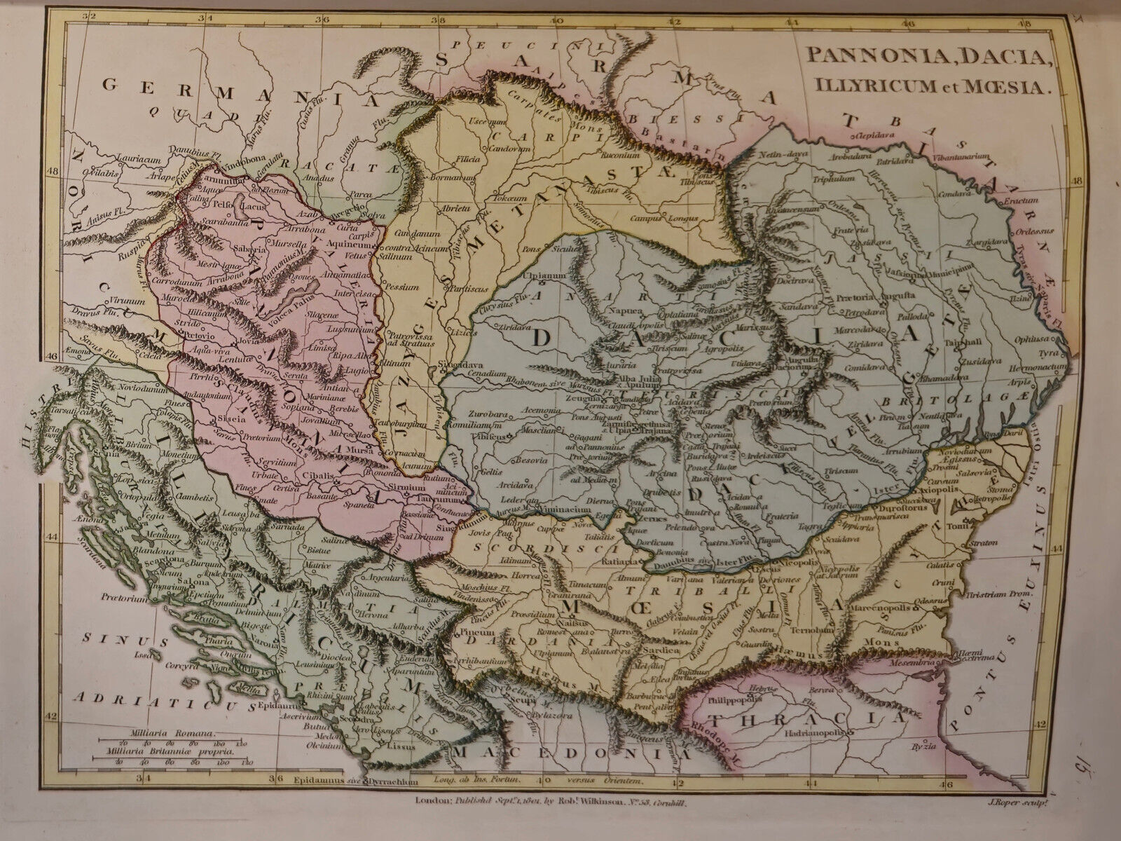
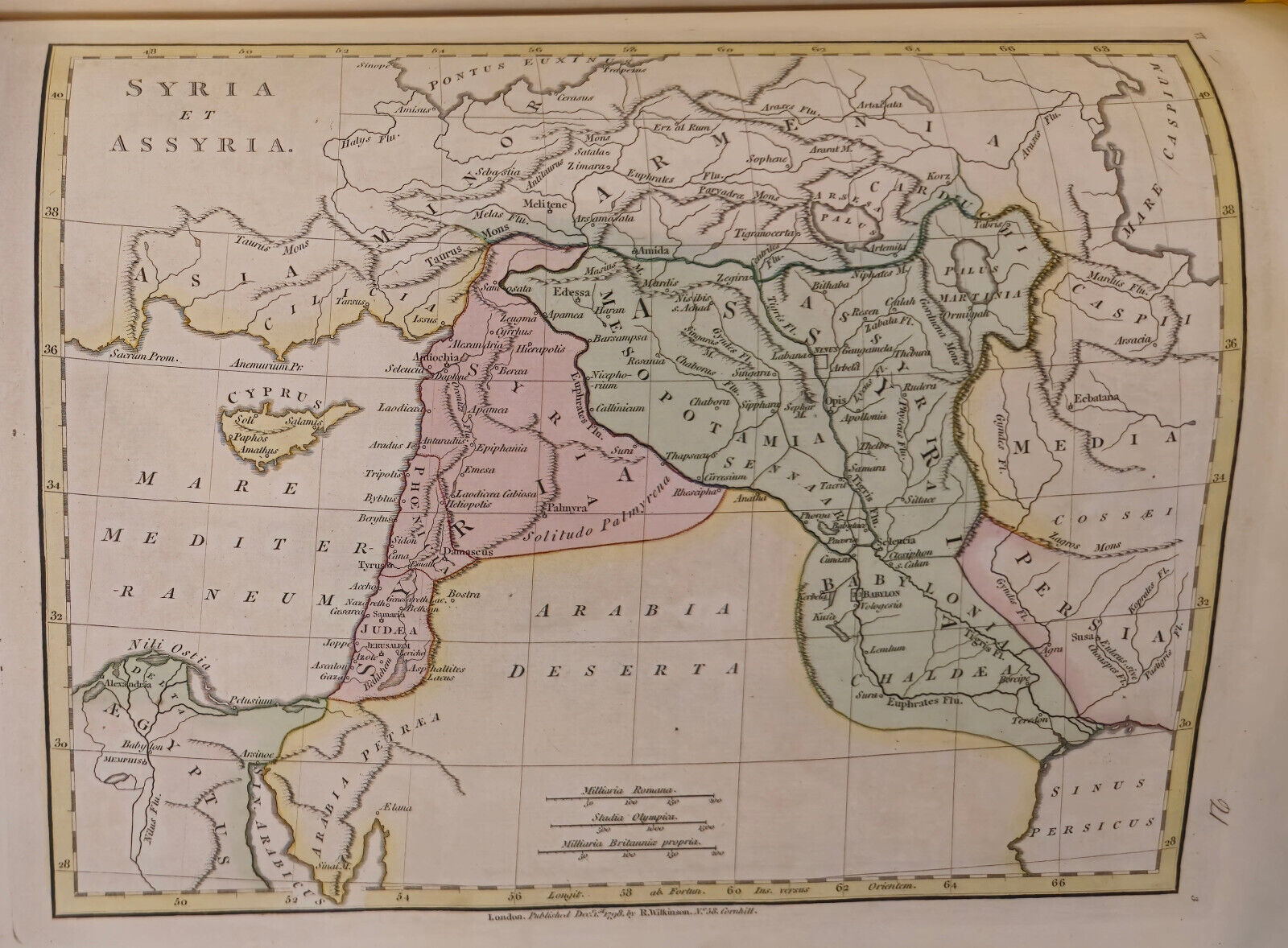
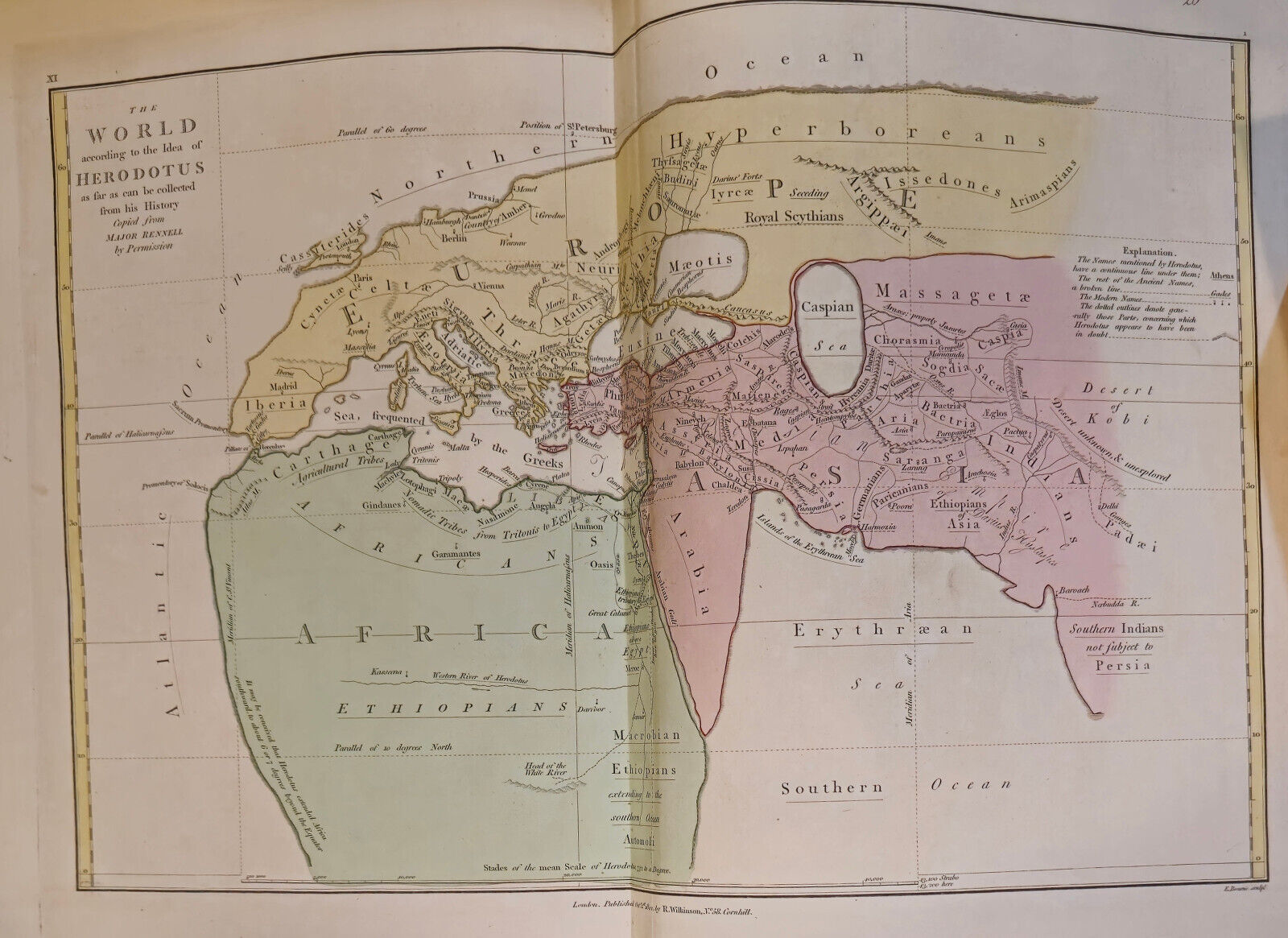
Wilkinson, Robert, Publisher. ATLAS CLASSICA: BEING A COLLECTION OF MAPS OF COUNTRIES MENTIONED IN THE ANCIENT AUTHORS BOTH SACRED AND PROFANE. London: Robt. Wilkinson, 1808.
Period oe polished calf/marbled paper boards hardcover, Folio (13.5x11?), good/n.a., 53 hand-colored maps and charts (one folding). The engraved title-page is dated 1797, several plates are dated from the later 1790s also, however index page is dated 1808 with several maps approaching that year also. Binding is quite well bumped and rubbed but holding firmly, top front joint is started approx. 3? down from the head, but overall intact; title-leaf soiled, both free fly-leaves are crushed but present, front fly-leaf lacking approx. 4? chip at tail of fore-edge and with previous owner?s signatures thereon, as well as a p.o.s. to head of title page, small (1/4?) tear to index, doodle to final map verso, maps generally quite clean - near fine, despite worn binding. A map of the U.S.A. is not included in this publication. It could have been special ordered, but apparently the initial purchaser did not see the need to do so.
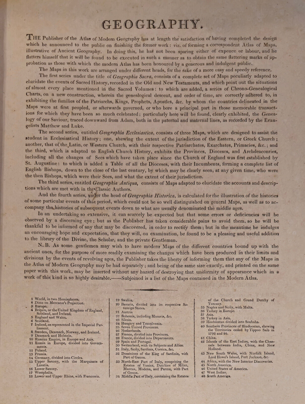
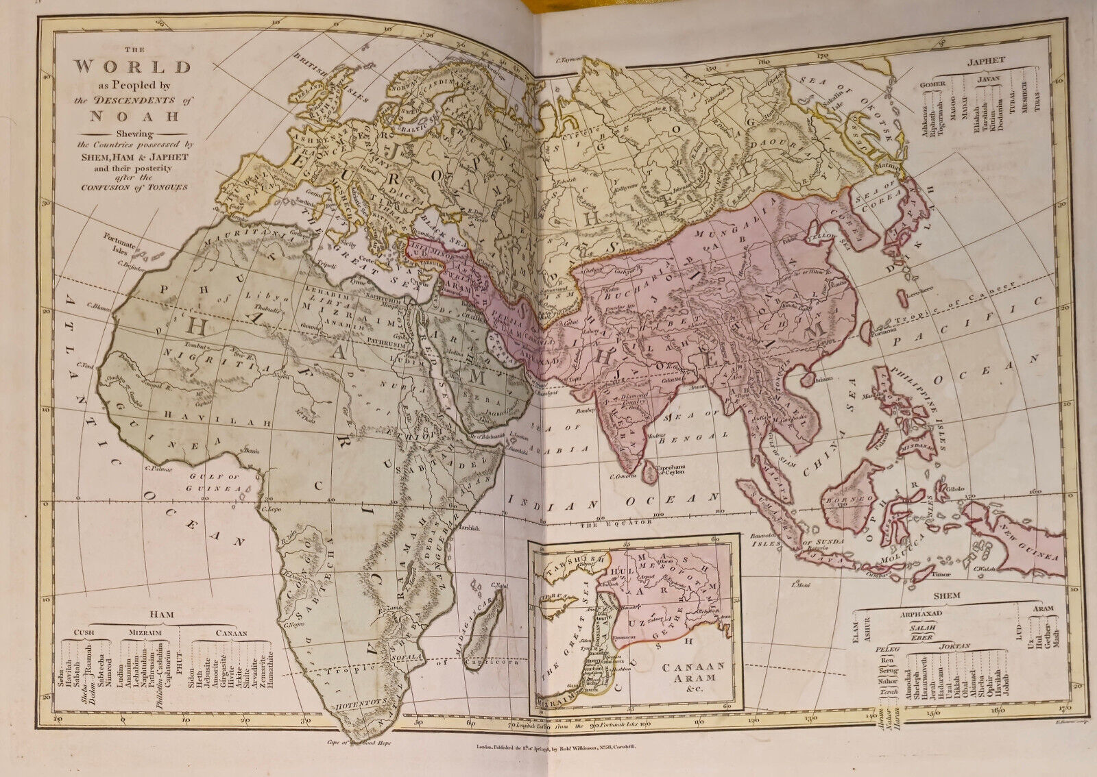
This magnificent atlas shows the regions of the world throughout biblical and classical history, with detailed charts corresponding to the peopling of the world and the description set out in the Bible with several maps detailing the geography and ways of the ancient ones as lain out in the classic writings. Herein is a journey into the world at the end of the 18th century and the years before. Quite interesting to see how much things have changed ? and how much they are the same.
A very distinctive book have we here ? quite the amazing, Capture of Tyme!
Added to your wish list!

- WILKINSON, ATLAS CLASSICA, 2nd ed. 1808 - 53 Handcolored Maps and Charts
- 1 in stock
- Price negotiable
- Handling time 2 day.
- Returns/refunds accepted
Get an item reminder
We'll email you a link to your item now and follow up with a single reminder (if you'd like one). That's it! No spam, no hassle.
Already have an account?
Log in and add this item to your wish list.